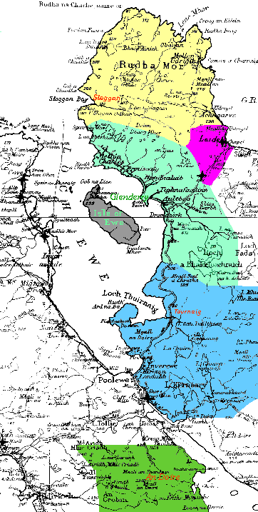
To help locate our little corner of the world, here is a set of maps.
As you can see, we are a long way from anywhere, even by Scottish standards.
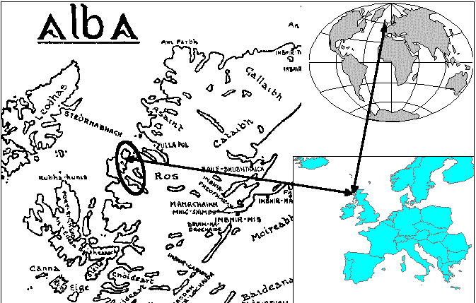
We show up on a map of northwestern Europe about as well as Denmark does on a map of the Globe, in other words, hardly. Our remoteness also worked to our advantage, for a speedy messenger took a fortnight, nearly as long to get from Glenderry to Edinburgh as from there to London, so most all contact with the King was initiated by us, not by the tax collector.
We have several other advantages in our location, as well, with some rich resources. While the Gulf Stream brings us storms in great profusion, it also provides us with plenty of fresh water (110 inches a year) and limits how cold it can get near shore, hence the modern Inverewe Gardens with some tropical plants living there within a few hundred meters of the shore. The entire area, where not exposed rock, is green.
Fishing is very close, and we catch salmon in the Ewe (and other places) and can maintain our shipping (read smuggling) with our small craft. Up the Ewe a few hundred meters is an early foundry, and bog iron exposed on the sides of Loch Ewe. Most of the area provides grazing, now sheep, but then our small, shaggy, hardy cattle (I've seen bigger dogs) who help us survive farther north than Moscow.
The landscape is heavily glaciated, with many small lakes (lochan), very green, with lots of exposed rock, and little flat land. Satellite view